
Thank you for supporting this site ❤️
Make a donation
Make a donation
Gear up for your next adventure:
As an Amazon Associate, this site earns from qualifying purchases at no extra cost to you.
Gunnarsbo topographic map
Click on the map to display elevation.
Thank you for supporting this site ❤️
Make a donation
Make a donation
Gear up for your next adventure:
As an Amazon Associate, this site earns from qualifying purchases at no extra cost to you.
About this map
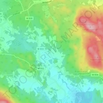
Name: Gunnarsbo topographic map, elevation, terrain.
Location: Gunnarsbo, Falun, Falu kommun, Dalarna County, 791 93, Sweden (60.54536 15.48235 60.58536 15.52235)
Average elevation: 528 ft
Minimum elevation: 358 ft
Maximum elevation: 896 ft
Thank you for supporting this site ❤️
Make a donation
Make a donation
Gear up for your next adventure:
As an Amazon Associate, this site earns from qualifying purchases at no extra cost to you.