Geolocate

Ellsworth topographic map

Click on the map to display elevation.

About this map

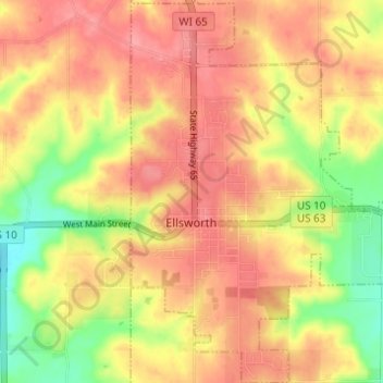
Name: Ellsworth topographic map, elevation, terrain.

Location: Ellsworth, Pierce County, Wisconsin, 54010, United States (44.71390 -92.49717 44.75748 -92.45648)

Average elevation: 1,145 ft

Minimum elevation: 974 ft

Maximum elevation: 1,250 ft

Pierce County trails, hiking, mountain biking, running and outdoor activities

Other topographic maps

Click on a map to view its topography, its elevation and its terrain.

Lake George

United States > Wisconsin > Pierce County > River Falls

Average elevation: 906 ft

Gear up for your next adventure:

🏕️Family Camping Gear - Essentials for group camping trips
Backpacking Tents - Weight-optimized shelters for multi-day topographic surveys
📱Solar Portable Charger - Solar power bank for charging devices off‑grid
🧥Men's Rain Shells - Premium waterproof and breathable jackets for mountain weather
🎒Trail Energy Bars - High‑calorie bars for hiking energy

As an Amazon Associate, this site earns from qualifying purchases at no extra cost to you.