
Rivèrenert topographic map
Interactive map
Click on the map to display elevation.
Rivèrenert
La superficie de la commune de est de 2 881 hectares ; son altitude varie de 462 à 1 415 mètres.
About this map
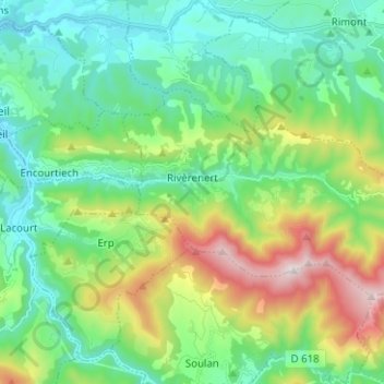
Name: Rivèrenert topographic map, elevation, terrain.
Average elevation: 2,244 ft
Minimum elevation: 1,312 ft
Maximum elevation: 4,616 ft