
Thank you for supporting this site ❤️
Make a donation
Make a donation
Gear up for your next adventure:
As an Amazon Associate, this site earns from qualifying purchases at no extra cost to you.
Pichihua topographic map
Click on the map to display elevation.
Thank you for supporting this site ❤️
Make a donation
Make a donation
Gear up for your next adventure:
As an Amazon Associate, this site earns from qualifying purchases at no extra cost to you.
About this map
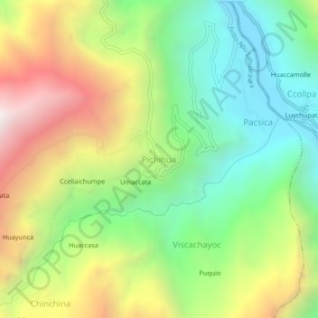
Name: Pichihua topographic map, elevation, terrain.
Location: Pichihua, Justo Apu Sahuaraura, Aymaraes, Apurímac, Perú (-14.16825 -73.19389 -14.12825 -73.15389)
Average elevation: 10,092 ft
Minimum elevation: 8,045 ft
Maximum elevation: 13,133 ft
Thank you for supporting this site ❤️
Make a donation
Make a donation
Gear up for your next adventure:
As an Amazon Associate, this site earns from qualifying purchases at no extra cost to you.