
Thank you for supporting this site ❤️
Make a donation
Make a donation
Gear up for your next adventure:
As an Amazon Associate, this site earns from qualifying purchases at no extra cost to you.
Rugarama topographic map
Click on the map to display elevation.
Thank you for supporting this site ❤️
Make a donation
Make a donation
Gear up for your next adventure:
As an Amazon Associate, this site earns from qualifying purchases at no extra cost to you.
About this map
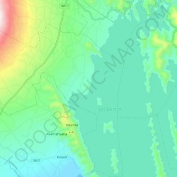
Name: Rugarama topographic map, elevation, terrain.
Location: Rugarama, Burera District, Northern Province, Rwanda (-1.47890 29.67918 -1.38140 29.77383)
Average elevation: 6,362 ft
Minimum elevation: 5,755 ft
Maximum elevation: 8,524 ft
Thank you for supporting this site ❤️
Make a donation
Make a donation
Gear up for your next adventure:
As an Amazon Associate, this site earns from qualifying purchases at no extra cost to you.