
Thank you for supporting this site ❤️
Make a donation
Make a donation
Gear up for your next adventure:
As an Amazon Associate, this site earns from qualifying purchases at no extra cost to you.
Vithura topographic map
Click on the map to display elevation.
Thank you for supporting this site ❤️
Make a donation
Make a donation
Gear up for your next adventure:
As an Amazon Associate, this site earns from qualifying purchases at no extra cost to you.
About this map
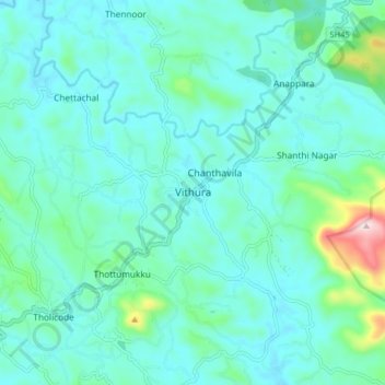
Name: Vithura topographic map, elevation, terrain.
Location: Vithura, Nedumangad, Thiruvananthapuram, Kerala, 695551, India (8.63000 77.04500 8.71000 77.12500)
Average elevation: 433 ft
Minimum elevation: 236 ft
Maximum elevation: 1,503 ft
Thank you for supporting this site ❤️
Make a donation
Make a donation
Gear up for your next adventure:
As an Amazon Associate, this site earns from qualifying purchases at no extra cost to you.