
Thank you for supporting this site ❤️
Make a donation
Make a donation
Gear up for your next adventure:
As an Amazon Associate, this site earns from qualifying purchases at no extra cost to you.
Picachos topographic map
Click on the map to display elevation.
Thank you for supporting this site ❤️
Make a donation
Make a donation
Gear up for your next adventure:
As an Amazon Associate, this site earns from qualifying purchases at no extra cost to you.
About this map
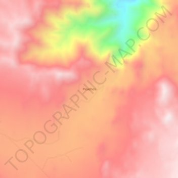
Name: Picachos topographic map, elevation, terrain.
Location: Picachos, Municipio de Tecate, Baja California, México (32.46989 -116.03656 32.50989 -115.99656)
Average elevation: 3,901 ft
Minimum elevation: 2,152 ft
Maximum elevation: 4,629 ft
Thank you for supporting this site ❤️
Make a donation
Make a donation
Gear up for your next adventure:
As an Amazon Associate, this site earns from qualifying purchases at no extra cost to you.