
Thank you for supporting this site ❤️
Make a donation
Make a donation
Gear up for your next adventure:
As an Amazon Associate, this site earns from qualifying purchases at no extra cost to you.
Jamika topographic map
Click on the map to display elevation.
Thank you for supporting this site ❤️
Make a donation
Make a donation
Gear up for your next adventure:
As an Amazon Associate, this site earns from qualifying purchases at no extra cost to you.
About this map
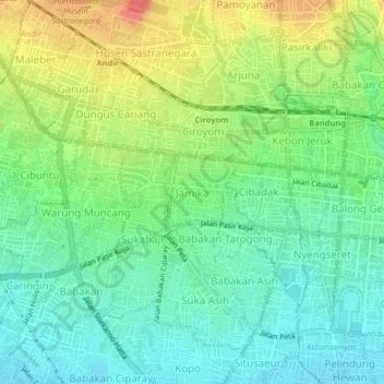
Name: Jamika topographic map, elevation, terrain.
Location: Jamika, Bojongloa Kaler, West Java, 40232, Indonesia (-6.94269 107.56826 -6.90269 107.60826)
Average elevation: 2,333 ft
Minimum elevation: 2,254 ft
Maximum elevation: 2,464 ft
Thank you for supporting this site ❤️
Make a donation
Make a donation
Gear up for your next adventure:
As an Amazon Associate, this site earns from qualifying purchases at no extra cost to you.