
Thank you for supporting this site ❤️
Make a donation
Make a donation
Gear up for your next adventure:
As an Amazon Associate, this site earns from qualifying purchases at no extra cost to you.
Bani topographic map
Click on the map to display elevation.
Thank you for supporting this site ❤️
Make a donation
Make a donation
Gear up for your next adventure:
As an Amazon Associate, this site earns from qualifying purchases at no extra cost to you.
About this map
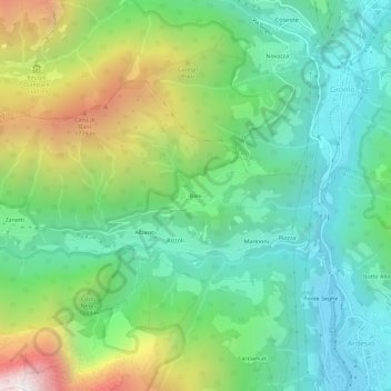
Name: Bani topographic map, elevation, terrain.
Location: Bani, Rizzoli, Ardesio, Bergamo, Lombardy, 24020, Italy (45.93306 9.88539 45.97306 9.92539)
Average elevation: 3,491 ft
Minimum elevation: 1,785 ft
Maximum elevation: 7,198 ft
Thank you for supporting this site ❤️
Make a donation
Make a donation
Gear up for your next adventure:
As an Amazon Associate, this site earns from qualifying purchases at no extra cost to you.