
Thank you for supporting this site ❤️
Make a donation
Make a donation
Gear up for your next adventure:
As an Amazon Associate, this site earns from qualifying purchases at no extra cost to you.
Tallangatta topographic map
Click on the map to display elevation.
Thank you for supporting this site ❤️
Make a donation
Make a donation
Gear up for your next adventure:
As an Amazon Associate, this site earns from qualifying purchases at no extra cost to you.
About this map
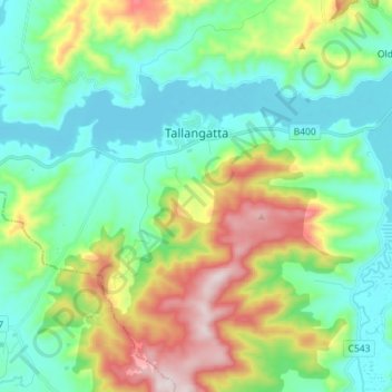
Name: Tallangatta topographic map, elevation, terrain.
Location: Tallangatta, Shire of Towong, Victoria, 3700, Australia (-36.26870 147.11462 -36.20204 147.25668)
Average elevation: 1,158 ft
Minimum elevation: 587 ft
Maximum elevation: 2,556 ft
Thank you for supporting this site ❤️
Make a donation
Make a donation
Gear up for your next adventure:
As an Amazon Associate, this site earns from qualifying purchases at no extra cost to you.