
Thank you for supporting this site ❤️
Make a donation
Make a donation
Gear up for your next adventure:
As an Amazon Associate, this site earns from qualifying purchases at no extra cost to you.
Tibasosa topographic map
Click on the map to display elevation.
Thank you for supporting this site ❤️
Make a donation
Make a donation
Gear up for your next adventure:
As an Amazon Associate, this site earns from qualifying purchases at no extra cost to you.
About this map
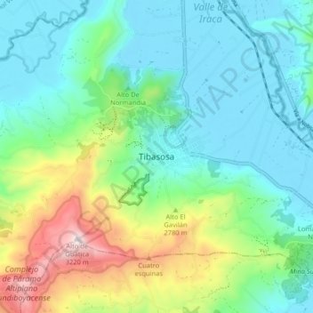
Name: Tibasosa topographic map, elevation, terrain.
Location: Tibasosa, Sugamuxi, Boyacá, RAP (Especial) Central, Colombia (5.70559 -73.04355 5.78559 -72.96355)
Average elevation: 8,750 ft
Minimum elevation: 8,110 ft
Maximum elevation: 10,561 ft
Thank you for supporting this site ❤️
Make a donation
Make a donation
Gear up for your next adventure:
As an Amazon Associate, this site earns from qualifying purchases at no extra cost to you.