
Make a donation
Gear up for your next adventure:
As an Amazon Associate, this site earns from qualifying purchases at no extra cost to you.
Saurimo topographic map
Click on the map to display elevation.
Make a donation
Gear up for your next adventure:
As an Amazon Associate, this site earns from qualifying purchases at no extra cost to you.
Saurimo
Saurimo is located in northeastern Angola at an elevation of 1,084 m (3,556 ft) above sea level. It is a garrison town and local market center.
Make a donation
Gear up for your next adventure:
As an Amazon Associate, this site earns from qualifying purchases at no extra cost to you.
About this map
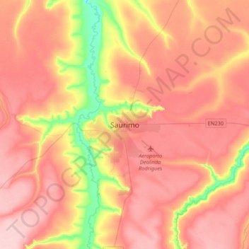
Name: Saurimo topographic map, elevation, terrain.
Location: Saurimo, Lunda Sul Province, Angola (-9.81893 20.23811 -9.49893 20.55811)
Average elevation: 3,497 ft
Minimum elevation: 3,159 ft
Maximum elevation: 3,701 ft
Make a donation
Gear up for your next adventure:
As an Amazon Associate, this site earns from qualifying purchases at no extra cost to you.