Geolocate

Dieng topographic map

Click on the map to display elevation.

About this map

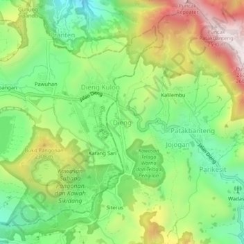
Name: Dieng topographic map, elevation, terrain.

Location: Dieng, Wonosobo, Central Java, Java, Indonesia (-7.22698 109.89198 -7.18698 109.93198)

Average elevation: 6,955 ft

Minimum elevation: 5,938 ft

Maximum elevation: 8,455 ft

Gear up for your next adventure:

📱Heavy-Duty Phone Cases - Drop-proof and waterproof protection for outdoor navigation
🪶Multi‑Purpose Knife - Useful blade for camp and trail
🚗GPS Dash Cams - Record your scenic drives through mountain passes and canyons
🪶Wildlife Field Guides - Learn animal tracking and species ID
⛑️Personal Locator Beacon - Safety beacon for emergencies

As an Amazon Associate, this site earns from qualifying purchases at no extra cost to you.