
Thank you for supporting this site ❤️
Make a donation
Make a donation
Gear up for your next adventure:
As an Amazon Associate, this site earns from qualifying purchases at no extra cost to you.
Ramalhal topographic map
Click on the map to display elevation.
Thank you for supporting this site ❤️
Make a donation
Make a donation
Gear up for your next adventure:
As an Amazon Associate, this site earns from qualifying purchases at no extra cost to you.
About this map
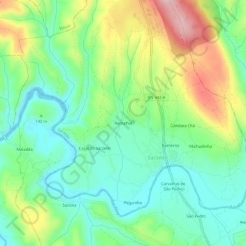
Name: Ramalhal topographic map, elevation, terrain.
Location: Ramalhal, Sarzedo, Arganil, Coimbra, 3304-909, Portugal (40.22614 -8.09803 40.26614 -8.05803)
Average elevation: 640 ft
Minimum elevation: 400 ft
Maximum elevation: 1,093 ft
Thank you for supporting this site ❤️
Make a donation
Make a donation
Gear up for your next adventure:
As an Amazon Associate, this site earns from qualifying purchases at no extra cost to you.