
Thank you for supporting this site ❤️
Make a donation
Make a donation
Gear up for your next adventure:
As an Amazon Associate, this site earns from qualifying purchases at no extra cost to you.
Atlas topographic map
Click on the map to display elevation.
Thank you for supporting this site ❤️
Make a donation
Make a donation
Gear up for your next adventure:
As an Amazon Associate, this site earns from qualifying purchases at no extra cost to you.
About this map
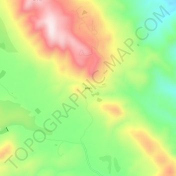
Name: Atlas topographic map, elevation, terrain.
Location: Atlas, Napa County, Californie, États-Unis d'Amérique (38.40908 -122.26803 38.44908 -122.22803)
Average elevation: 1,647 ft
Minimum elevation: 863 ft
Maximum elevation: 2,572 ft
Thank you for supporting this site ❤️
Make a donation
Make a donation
Gear up for your next adventure:
As an Amazon Associate, this site earns from qualifying purchases at no extra cost to you.