
Thank you for supporting this site ❤️
Make a donation
Make a donation
Gear up for your next adventure:
As an Amazon Associate, this site earns from qualifying purchases at no extra cost to you.
Klerken topographic map
Click on the map to display elevation.
Thank you for supporting this site ❤️
Make a donation
Make a donation
Gear up for your next adventure:
As an Amazon Associate, this site earns from qualifying purchases at no extra cost to you.
About this map
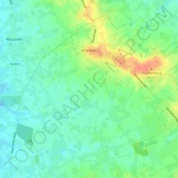
Name: Klerken topographic map, elevation, terrain.
Location: Klerken, Houthulst, Diksmuide, West Flanders, 8650, Belgium (50.97262 2.89615 51.00841 2.94048)
Average elevation: 49 ft
Minimum elevation: 7 ft
Maximum elevation: 138 ft
Thank you for supporting this site ❤️
Make a donation
Make a donation
Gear up for your next adventure:
As an Amazon Associate, this site earns from qualifying purchases at no extra cost to you.