
Thank you for supporting this site ❤️
Make a donation
Make a donation
Gear up for your next adventure:
As an Amazon Associate, this site earns from qualifying purchases at no extra cost to you.
Virginia topographic map
Click on the map to display elevation.
Thank you for supporting this site ❤️
Make a donation
Make a donation
Gear up for your next adventure:
As an Amazon Associate, this site earns from qualifying purchases at no extra cost to you.
About this map
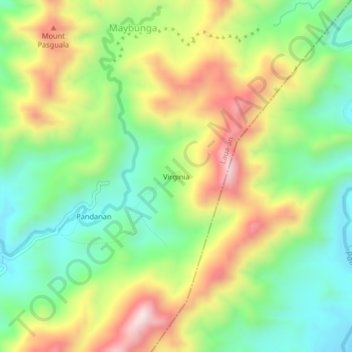
Name: Virginia topographic map, elevation, terrain.
Location: Virginia, Laua-an, Antique, Western Visayas, Philippines (11.11577 122.11035 11.15577 122.15035)
Average elevation: 1,099 ft
Minimum elevation: 331 ft
Maximum elevation: 2,208 ft
Thank you for supporting this site ❤️
Make a donation
Make a donation
Gear up for your next adventure:
As an Amazon Associate, this site earns from qualifying purchases at no extra cost to you.