
Gomat topographic map
Interactive map
Click on the map to display elevation.
About this map
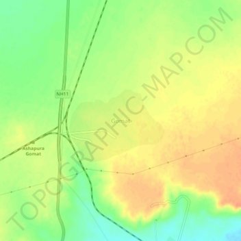
Name: Gomat topographic map, elevation, terrain.
Location: Gomat, Pokaran Tehsil, Jaisalmer District, Rajasthan, India (26.93415 71.88934 26.97415 71.92934)
Average elevation: 807 ft
Minimum elevation: 732 ft
Maximum elevation: 863 ft
Other topographic maps
Click on a map to view its topography, its elevation and its terrain.
Bodana
India > Rajasthan > Pokaran Tehsil
Bodana, Pokaran Tehsil, Jaisalmer District, Rajasthan, India
Average elevation: 561 ft