
Kampung Merdeka topographic map
Click on the map to display elevation.
About this map
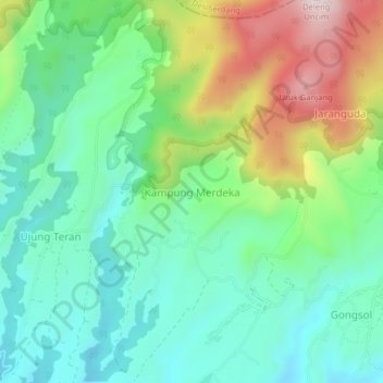
Name: Kampung Merdeka topographic map, elevation, terrain.
Location: Kampung Merdeka, Karo, North Sumatra, Sumatra, 22153, Indonesia (3.18416 98.45391 3.22416 98.49391)
Average elevation: 4,816 ft
Minimum elevation: 4,285 ft
Maximum elevation: 5,971 ft
Other topographic maps
Click on a map to view its topography, its elevation and its terrain.