
Thank you for supporting this site ❤️
Make a donation
Make a donation
Gear up for your next adventure:
As an Amazon Associate, this site earns from qualifying purchases at no extra cost to you.
Großdehsa topographic map
Click on the map to display elevation.
Thank you for supporting this site ❤️
Make a donation
Make a donation
Gear up for your next adventure:
As an Amazon Associate, this site earns from qualifying purchases at no extra cost to you.
About this map
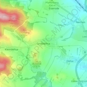
Name: Großdehsa topographic map, elevation, terrain.
Location: Großdehsa, Löbau, Görlitz, Sachsen, 02708, Deutschland (51.08760 14.59587 51.12760 14.63587)
Average elevation: 1,083 ft
Minimum elevation: 879 ft
Maximum elevation: 1,545 ft
Thank you for supporting this site ❤️
Make a donation
Make a donation
Gear up for your next adventure:
As an Amazon Associate, this site earns from qualifying purchases at no extra cost to you.