
Thank you for supporting this site ❤️
Make a donation
Make a donation
Gear up for your next adventure:
As an Amazon Associate, this site earns from qualifying purchases at no extra cost to you.
Mulyasari topographic map
Click on the map to display elevation.
Thank you for supporting this site ❤️
Make a donation
Make a donation
Gear up for your next adventure:
As an Amazon Associate, this site earns from qualifying purchases at no extra cost to you.
About this map
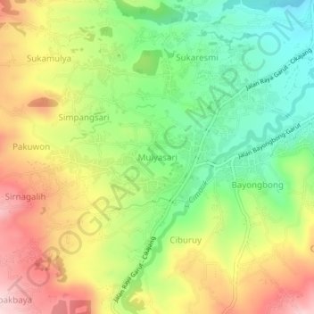
Name: Mulyasari topographic map, elevation, terrain.
Location: Mulyasari, Garut, West Java, Java, 44162, Indonesia (-7.29070 107.78917 -7.25070 107.82917)
Average elevation: 3,422 ft
Minimum elevation: 3,012 ft
Maximum elevation: 3,914 ft
Thank you for supporting this site ❤️
Make a donation
Make a donation
Gear up for your next adventure:
As an Amazon Associate, this site earns from qualifying purchases at no extra cost to you.