
Make a donation
Gear up for your next adventure:
As an Amazon Associate, this site earns from qualifying purchases at no extra cost to you.
Hayfield topographic map
Click on the map to display elevation.
Make a donation
Gear up for your next adventure:
As an Amazon Associate, this site earns from qualifying purchases at no extra cost to you.
About this map
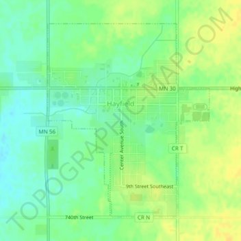
Name: Hayfield topographic map, elevation, terrain.
Location: Hayfield, Dodge County, Minnesota, United States (43.87787 -92.85925 43.89957 -92.83408)
Average elevation: 1,325 ft
Minimum elevation: 1,286 ft
Maximum elevation: 1,362 ft
Dodge County trails, hiking, mountain biking, running and outdoor activities
Make a donation
Gear up for your next adventure:
As an Amazon Associate, this site earns from qualifying purchases at no extra cost to you.
Other topographic maps
Click on a map to view its topography, its elevation and its terrain.
Natalie Webb Familly Aquatic Center
United States > Minnesota > Dodge County > Dodge Center > Valley View Park
Average elevation: 1,260 ft