
Thank you for supporting this site ❤️
Make a donation
Make a donation
Gear up for your next adventure:
As an Amazon Associate, this site earns from qualifying purchases at no extra cost to you.
Gakeri topographic map
Click on the map to display elevation.
Thank you for supporting this site ❤️
Make a donation
Make a donation
Gear up for your next adventure:
As an Amazon Associate, this site earns from qualifying purchases at no extra cost to you.
About this map
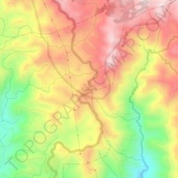
Name: Gakeri topographic map, elevation, terrain.
Location: Gakeri, Mushonyi, Rutsiro, Western Province, Rwanda (-1.87928 29.33901 -1.83928 29.37901)
Average elevation: 6,719 ft
Minimum elevation: 5,751 ft
Maximum elevation: 7,497 ft
Thank you for supporting this site ❤️
Make a donation
Make a donation
Gear up for your next adventure:
As an Amazon Associate, this site earns from qualifying purchases at no extra cost to you.