Geolocate

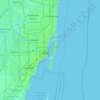
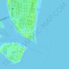
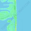
Soundscape Park topographic map

Click on the map to display elevation.

About this map

Name: Soundscape Park topographic map, elevation, terrain.

Location: Soundscape Park, Miami Beach, Miami-Dade County, Florida, United States (25.79121 -80.13310 25.79213 -80.13208)

Average elevation: 16 ft

Minimum elevation: -7 ft

Maximum elevation: 98 ft

Miami-Dade County trails, hiking, mountain biking, running and outdoor activities

Other topographic maps

Click on a map to view its topography, its elevation and its terrain.
Gear up for your next adventure:

📡GPS Antenna Upgrade - Enhance GPS reception in remote terrain
🪑Ultralight Camp Chairs - Portable seating for resting after a long day of mapping
🦟Ultrasonic Repellers - Create a bug-free zone at your camp or rest stop
⌚Solar GPS Watches - Advanced multisport watches with built-in topographic maps
📚Navigation Handbooks - Master the art of reading topographic maps and using a compass

As an Amazon Associate, this site earns from qualifying purchases at no extra cost to you.