
Yatesville topographic map
Interactive map
Click on the map to display elevation.
About this map
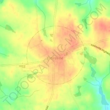
Name: Yatesville topographic map, elevation, terrain.
Location: Yatesville, Upson County, Georgia, United States (32.90734 -84.15236 32.92164 -84.13392)
Average elevation: 735 ft
Minimum elevation: 636 ft
Maximum elevation: 791 ft
Other topographic maps
Click on a map to view its topography, its elevation and its terrain.
Hannahs Mill
United States > Georgia > Upson County
Hannahs Mill, Upson County, Georgia, 30286, United States
Average elevation: 728 ft
Salem
United States > Georgia > Upson County
Salem, Upson County, Georgia, United States
Average elevation: 469 ft
Thomaston
United States > Georgia > Upson County
Thomaston, Upson County, Georgia, United States
Average elevation: 702 ft