
Thank you for supporting this site ❤️
Make a donation
Make a donation
Gear up for your next adventure:
As an Amazon Associate, this site earns from qualifying purchases at no extra cost to you.
Ferry topographic map
Click on the map to display elevation.
Thank you for supporting this site ❤️
Make a donation
Make a donation
Gear up for your next adventure:
As an Amazon Associate, this site earns from qualifying purchases at no extra cost to you.
About this map
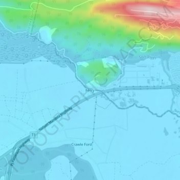
Name: Ferry topographic map, elevation, terrain.
Location: Ferry, Portmore, Saint Catherine, Middlesex County, Jamaica (18.00528 -76.89570 18.04528 -76.85570)
Average elevation: 144 ft
Minimum elevation: 3 ft
Maximum elevation: 1,175 ft
Thank you for supporting this site ❤️
Make a donation
Make a donation
Gear up for your next adventure:
As an Amazon Associate, this site earns from qualifying purchases at no extra cost to you.