
Thank you for supporting this site ❤️
Make a donation
Make a donation
Gear up for your next adventure:
As an Amazon Associate, this site earns from qualifying purchases at no extra cost to you.
Alforja topographic map
Click on the map to display elevation.
Thank you for supporting this site ❤️
Make a donation
Make a donation
Gear up for your next adventure:
As an Amazon Associate, this site earns from qualifying purchases at no extra cost to you.
About this map
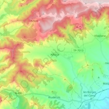
Name: Alforja topographic map, elevation, terrain.
Location: Alforja, Baix Camp, Tarragona, Catalonia, 43365, Spain (41.17833 0.87711 41.24096 1.01739)
Average elevation: 1,722 ft
Minimum elevation: 522 ft
Maximum elevation: 3,399 ft
Thank you for supporting this site ❤️
Make a donation
Make a donation
Gear up for your next adventure:
As an Amazon Associate, this site earns from qualifying purchases at no extra cost to you.