Geolocate

Nari topographic map

Click on the map to display elevation.

About this map

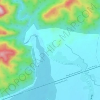
Name: Nari topographic map, elevation, terrain.

Location: Nari, Nari ADC, Lower Siang, Arunachal Pradesh, India (27.78116 95.02354 27.82116 95.06354)

Average elevation: 646 ft

Minimum elevation: 387 ft

Maximum elevation: 1,673 ft

Gear up for your next adventure:

🔌Solar Panel Charger - Charge gear sustainably outdoors
📱Solar Portable Charger - Solar power bank for charging devices off‑grid
📡Handheld GPS Device - Reliable handheld GPS for outdoor navigation
🧭Compass with Lanyard - Easy‑carry compass for navigation
🪑Ultralight Camp Chairs - Portable seating for resting after a long day of mapping

As an Amazon Associate, this site earns from qualifying purchases at no extra cost to you.