
Thank you for supporting this site ❤️
Make a donation
Make a donation
Gear up for your next adventure:
As an Amazon Associate, this site earns from qualifying purchases at no extra cost to you.
Redjem Demouche topographic map
Click on the map to display elevation.
Thank you for supporting this site ❤️
Make a donation
Make a donation
Gear up for your next adventure:
As an Amazon Associate, this site earns from qualifying purchases at no extra cost to you.
About this map
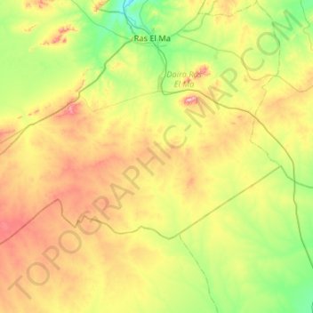
Name: Redjem Demouche topographic map, elevation, terrain.
Location: Redjem Demouche, Ras El Ma District, Sidi Bel Abbès, Algeria (34.21740 -1.12525 34.45990 -0.60415)
Average elevation: 3,865 ft
Minimum elevation: 3,442 ft
Maximum elevation: 4,603 ft
Thank you for supporting this site ❤️
Make a donation
Make a donation
Gear up for your next adventure:
As an Amazon Associate, this site earns from qualifying purchases at no extra cost to you.