
Thank you for supporting this site ❤️
Make a donation
Make a donation
Gear up for your next adventure:
As an Amazon Associate, this site earns from qualifying purchases at no extra cost to you.
Lochtum topographic map
Click on the map to display elevation.
Thank you for supporting this site ❤️
Make a donation
Make a donation
Gear up for your next adventure:
As an Amazon Associate, this site earns from qualifying purchases at no extra cost to you.
About this map
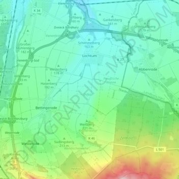
Name: Lochtum topographic map, elevation, terrain.
Location: Lochtum, Goslar, Landkreis Goslar, Lower Saxony, Germany (51.88965 10.57225 51.94903 10.62707)
Average elevation: 643 ft
Minimum elevation: 443 ft
Maximum elevation: 1,243 ft
Thank you for supporting this site ❤️
Make a donation
Make a donation
Gear up for your next adventure:
As an Amazon Associate, this site earns from qualifying purchases at no extra cost to you.