
Thank you for supporting this site ❤️
Make a donation
Make a donation
Gear up for your next adventure:
As an Amazon Associate, this site earns from qualifying purchases at no extra cost to you.
Bannack topographic map
Click on the map to display elevation.
Thank you for supporting this site ❤️
Make a donation
Make a donation
Gear up for your next adventure:
As an Amazon Associate, this site earns from qualifying purchases at no extra cost to you.
About this map
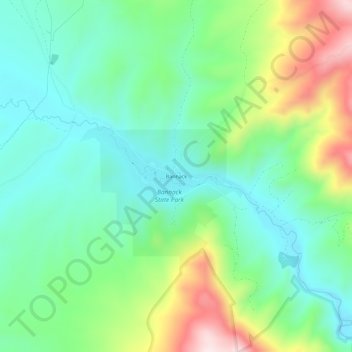
Name: Bannack topographic map, elevation, terrain.
Location: Bannack, Beaverhead County, Montana, United States (45.14103 -113.01559 45.18103 -112.97559)
Average elevation: 6,158 ft
Minimum elevation: 5,699 ft
Maximum elevation: 7,185 ft
Beaverhead County trails, hiking, mountain biking, running and outdoor activities
Thank you for supporting this site ❤️
Make a donation
Make a donation
Gear up for your next adventure:
As an Amazon Associate, this site earns from qualifying purchases at no extra cost to you.