
Thank you for supporting this site ❤️
Make a donation
Make a donation
Gear up for your next adventure:
As an Amazon Associate, this site earns from qualifying purchases at no extra cost to you.
Swain topographic map
Click on the map to display elevation.
Thank you for supporting this site ❤️
Make a donation
Make a donation
Gear up for your next adventure:
As an Amazon Associate, this site earns from qualifying purchases at no extra cost to you.
About this map
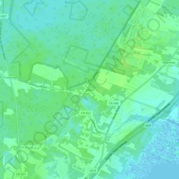
Name: Swain topographic map, elevation, terrain.
Average elevation: 16 ft
Minimum elevation: -10 ft
Maximum elevation: 36 ft
Thank you for supporting this site ❤️
Make a donation
Make a donation
Gear up for your next adventure:
As an Amazon Associate, this site earns from qualifying purchases at no extra cost to you.
Other topographic maps
Click on a map to view its topography, its elevation and its terrain.
Rio Grande
United States > New Jersey > Cape May County > Middle Township > Rio Grande
Average elevation: 16 ft
The Wetlands Institute
United States > New Jersey > Cape May County > Middle Township > Stone Harbor Manor
Average elevation: 3 ft