
Mosquito Lake topographic map
Interactive map
Click on the map to display elevation.
About this map
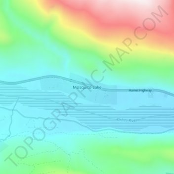
Name: Mosquito Lake topographic map, elevation, terrain.
Location: Mosquito Lake, Haines, Alaska, United States (59.41166 -136.20756 59.45166 -136.16756)
Average elevation: 1,230 ft
Minimum elevation: 364 ft
Maximum elevation: 3,832 ft
Other topographic maps
Click on a map to view its topography, its elevation and its terrain.
Mud Bay
United States > Alaska > Haines
Mud Bay, Haines, Alaska, United States
Average elevation: 157 ft
Excursion Inlet
United States > Alaska > Haines
Excursion Inlet, Haines, Alaska, United States
Average elevation: 486 ft
Covenant Life
United States > Alaska > Haines
Covenant Life, Haines, Alaska, United States
Average elevation: 384 ft
Sullivan Island
United States > Alaska > Haines
Sullivan Island, Haines, Alaska, United States
Average elevation: 220 ft