
Танга topographic map
Interactive map
Click on the map to display elevation.
About this map
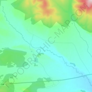
Name: Танга topographic map, elevation, terrain.
Average elevation: 3,120 ft
Minimum elevation: 2,881 ft
Maximum elevation: 4,177 ft
Other topographic maps
Click on a map to view its topography, its elevation and its terrain.
Танга
Russia > Zabaykalsky Krai > Тангинское сельское поселение
Танга, Тангинское сельское поселение, Ulyotovsky District, Zabaykalsky Krai, Siberian Federal District, 674071, Russia
Average elevation: 2,953 ft