
Thank you for supporting this site ❤️
Make a donation
Make a donation
Gear up for your next adventure:
As an Amazon Associate, this site earns from qualifying purchases at no extra cost to you.
Bai topographic map
Click on the map to display elevation.
Thank you for supporting this site ❤️
Make a donation
Make a donation
Gear up for your next adventure:
As an Amazon Associate, this site earns from qualifying purchases at no extra cost to you.
About this map
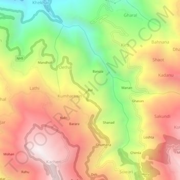
Name: Bai topographic map, elevation, terrain.
Location: Bai, Kumharsain, Shimla, Himachal Pradesh, 172029, India (31.29925 77.43314 31.33925 77.47314)
Average elevation: 5,043 ft
Minimum elevation: 2,720 ft
Maximum elevation: 7,103 ft
Thank you for supporting this site ❤️
Make a donation
Make a donation
Gear up for your next adventure:
As an Amazon Associate, this site earns from qualifying purchases at no extra cost to you.