
Thank you for supporting this site ❤️
Make a donation
Make a donation
Gear up for your next adventure:
As an Amazon Associate, this site earns from qualifying purchases at no extra cost to you.
Chalco topographic map
Click on the map to display elevation.
Thank you for supporting this site ❤️
Make a donation
Make a donation
Gear up for your next adventure:
As an Amazon Associate, this site earns from qualifying purchases at no extra cost to you.
About this map
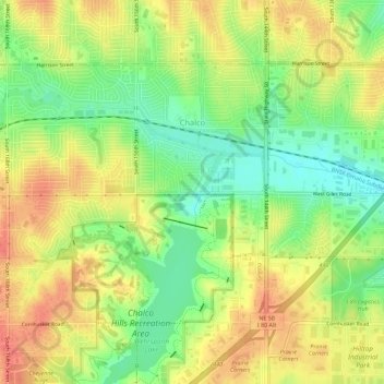
Name: Chalco topographic map, elevation, terrain.
Location: Chalco, Sarpy County, Nebraska, 68138, United States (41.16187 -96.15835 41.19083 -96.10122)
Average elevation: 1,135 ft
Minimum elevation: 1,037 ft
Maximum elevation: 1,224 ft
Sarpy County trails, hiking, mountain biking, running and outdoor activities
Thank you for supporting this site ❤️
Make a donation
Make a donation
Gear up for your next adventure:
As an Amazon Associate, this site earns from qualifying purchases at no extra cost to you.