
Make a donation
Gear up for your next adventure:
As an Amazon Associate, this site earns from qualifying purchases at no extra cost to you.
Good Hope topographic map
Click on the map to display elevation.
Make a donation
Gear up for your next adventure:
As an Amazon Associate, this site earns from qualifying purchases at no extra cost to you.
About this map
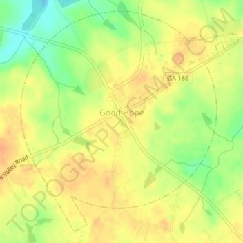
Name: Good Hope topographic map, elevation, terrain.
Location: Good Hope, Walton County, Georgia, United States (33.77156 -83.62257 33.79606 -83.59338)
Average elevation: 787 ft
Minimum elevation: 709 ft
Maximum elevation: 833 ft
Walton County trails, hiking, mountain biking, running and outdoor activities
Make a donation
Gear up for your next adventure:
As an Amazon Associate, this site earns from qualifying purchases at no extra cost to you.
Other topographic maps
Click on a map to view its topography, its elevation and its terrain.
Alcovy Mountain
United States > Georgia > Walton County
Alcovy Mountain is a monadnock in the U.S. state of Georgia similar to Kennesaw Mountain in the city of Marietta. It is located in Walton County four miles south of the city of Monroe. With a summit elevation of 1,128 ft (344 m), the mountain is the highest point in Walton County, and is the southeastern-most…
Average elevation: 745 ft