
Antheit topographic map
Interactive map
Click on the map to display elevation.
About this map
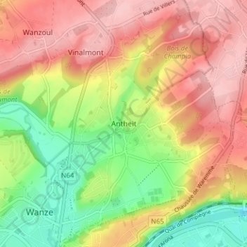
Name: Antheit topographic map, elevation, terrain.
Location: Antheit, Wanze, Huy, Liège, Wallonie, 4520, Belgique (50.53120 5.21585 50.57120 5.25585)
Average elevation: 449 ft
Minimum elevation: 180 ft
Maximum elevation: 676 ft
Other topographic maps
Click on a map to view its topography, its elevation and its terrain.
Le Tilleul
Belgique > Liège > Huy > Wanze > Le Tilleul
Le Tilleul, Wanze, Huy, Liège, Wallonie, 4520, Belgique
Average elevation: 390 ft