Geolocate

Ghat topographic map

Click on the map to display elevation.

About this map

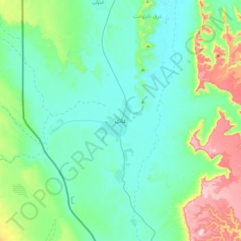
Name: Ghat topographic map, elevation, terrain.

Location: Ghat, Libya (24.80263 10.01972 25.12263 10.33972)

Average elevation: 2,572 ft

Minimum elevation: 2,103 ft

Maximum elevation: 4,426 ft

Gear up for your next adventure:

🎒Outdoor Daypacks - Lightweight backpacks designed for carrying maps and essential gear
🗻Climbing Gear Basics - Essential gear for beginner climbers
🧦Merino Wool Socks - Moisture-wicking, blister-preventing socks for long treks
🥄Camping Utensil Set - Lightweight utensils for outdoor meals
🗺️NatGeo Topo Maps - High-quality waterproof printed topographic maps of US Parks

As an Amazon Associate, this site earns from qualifying purchases at no extra cost to you.