
Make a donation
Gear up for your next adventure:
As an Amazon Associate, this site earns from qualifying purchases at no extra cost to you.
Passwang topographic map
Click on the map to display elevation.
Make a donation
Gear up for your next adventure:
As an Amazon Associate, this site earns from qualifying purchases at no extra cost to you.
Passwang
Der Passwang, früher auch Barschwang (solothurnerdeutsch Ba(r)schwang [baʳʃˈvaŋ], [baʃˈvaŋ]), ist ein Bergkamm auf dem Gemeindegebiet von Mümliswil-Ramiswil im Solothurner Jura, Schweiz. Hauptgipfel des Bergkamms ist der Vogelberg 1204 m ü. M. Anteil am Massiv des Passwang haben auch die solothurnische Gemeinde Beinwil (im Nordwesten) und, im Kanton Basel-Landschaft, Lauwil (im Norden) und Reigoldswil (im Nordosten). Über den Passwang führt der gleichnamige Gebirgspass mit einer Strasse, die mit einer Passhöhe von 943 m ü. M. über Mümliswil und Beinwil die südlichen Teile des Kantons Solothurn mit dem Schwarzbubenland verbindet. Die heutige Passhöhe liegt in einem kurzen Tunnel. Rund 700 Meter östlich des nördlichen Tunnelportals liegt die Passwanghöhe (992 m ü. M.) und weitere 150 Meter östlich am Wegweiser Mittler Passwang mit 1001 m ü. M. der höchste Punkt der historischen Passstrasse über den Bergkamm. Der Passwang gilt auch als Aussichtspunkt.
Make a donation
Gear up for your next adventure:
As an Amazon Associate, this site earns from qualifying purchases at no extra cost to you.
About this map
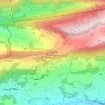
Name: Passwang topographic map, elevation, terrain.
Average elevation: 2,831 ft
Minimum elevation: 1,982 ft
Maximum elevation: 3,855 ft
Make a donation
Gear up for your next adventure:
As an Amazon Associate, this site earns from qualifying purchases at no extra cost to you.