
Thank you for supporting this site ❤️
Make a donation
Make a donation
Gear up for your next adventure:
As an Amazon Associate, this site earns from qualifying purchases at no extra cost to you.
Oberholz topographic map
Click on the map to display elevation.
Thank you for supporting this site ❤️
Make a donation
Make a donation
Gear up for your next adventure:
As an Amazon Associate, this site earns from qualifying purchases at no extra cost to you.
About this map
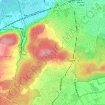
Name: Oberholz topographic map, elevation, terrain.
Location: Oberholz, Aarau, Bezirk Aarau, Aargau, 5000, Switzerland (47.37713 8.04138 47.37723 8.04148)
Average elevation: 1,388 ft
Minimum elevation: 1,191 ft
Maximum elevation: 1,601 ft
Thank you for supporting this site ❤️
Make a donation
Make a donation
Gear up for your next adventure:
As an Amazon Associate, this site earns from qualifying purchases at no extra cost to you.