
Thank you for supporting this site ❤️
Make a donation
Make a donation
Gear up for your next adventure:
As an Amazon Associate, this site earns from qualifying purchases at no extra cost to you.
Curup topographic map
Click on the map to display elevation.
Thank you for supporting this site ❤️
Make a donation
Make a donation
Gear up for your next adventure:
As an Amazon Associate, this site earns from qualifying purchases at no extra cost to you.
About this map
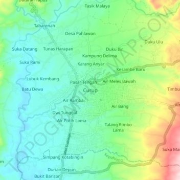
Name: Curup topographic map, elevation, terrain.
Location: Curup, Rejang Lebong, Bengkulu, Sumatra, Indonesia (-3.50762 102.49011 -3.42762 102.57011)
Average elevation: 2,221 ft
Minimum elevation: 1,919 ft
Maximum elevation: 3,064 ft
Thank you for supporting this site ❤️
Make a donation
Make a donation
Gear up for your next adventure:
As an Amazon Associate, this site earns from qualifying purchases at no extra cost to you.