
Millarville topographic map
Interactive map
Click on the map to display elevation.
About this map
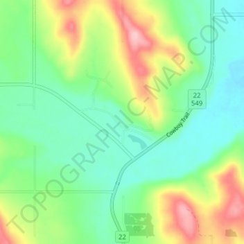
Name: Millarville topographic map, elevation, terrain.
Location: Millarville, Foothills County, Alberta, T0L 1K0, Canada (50.73815 -114.34538 50.77815 -114.30538)
Average elevation: 4,003 ft
Minimum elevation: 3,832 ft
Maximum elevation: 4,341 ft
Other topographic maps
Click on a map to view its topography, its elevation and its terrain.
Cayley
Canada > Alberta > Foothills County
Cayley, Foothills County, Alberta, Canada
Average elevation: 3,510 ft