
Manang topographic map
Interactive map
Click on the map to display elevation.
About this map
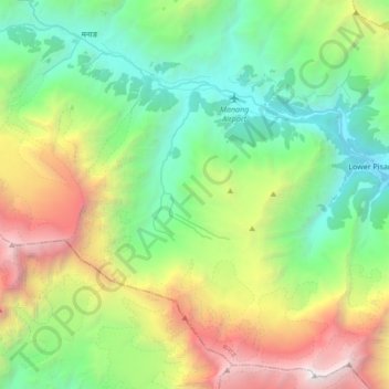
Name: Manang topographic map, elevation, terrain.
Location: Manang, Gandaki, Western Development Region, Nepal (28.53882 83.96336 28.67002 84.13392)
Average elevation: 15,636 ft
Minimum elevation: 10,479 ft
Maximum elevation: 26,060 ft