
Fidelis topographic map
Click on the map to display elevation.
About this map
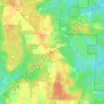
Name: Fidelis topographic map, elevation, terrain.
Location: Fidelis, Santa Rosa County, Florida, United States (30.91629 -87.04413 30.95629 -87.00413)
Average elevation: 233 ft
Minimum elevation: 161 ft
Maximum elevation: 299 ft
Santa Rosa County trails, hiking, mountain biking, running and outdoor activities
Other topographic maps
Click on a map to view its topography, its elevation and its terrain.