
Espot topographic map
Click on the map to display elevation.
About this map
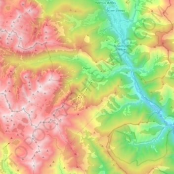
Name: Espot topographic map, elevation, terrain.
Location: Espot, Pallars Sobirà, Lleida, Catalonia, Spain (42.50877 0.93720 42.61015 1.14621)
Average elevation: 6,125 ft
Minimum elevation: 2,782 ft
Maximum elevation: 9,600 ft
Other topographic maps
Click on a map to view its topography, its elevation and its terrain.
Gerri de la Sal
Spain > Catalonia > Pallars Sobirà > Baix Pallars > Gerri de la Sal
Average elevation: 2,733 ft