Geolocate

Kandalama topographic map

Click on the map to display elevation.

About this map

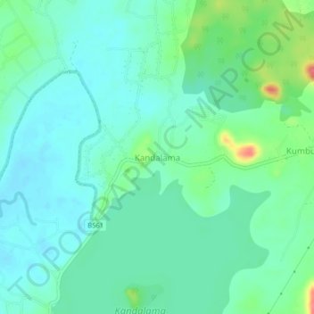
Name: Kandalama topographic map, elevation, terrain.

Location: Kandalama, Matale District, Central Province, Sri Lanka (7.87542 80.68453 7.91542 80.72453)

Average elevation: 584 ft

Minimum elevation: 528 ft

Maximum elevation: 751 ft

Other topographic maps

Click on a map to view its topography, its elevation and its terrain.

Matale District

Sri Lanka > Central Province

Average elevation: 886 ft

Upper Kotmale Dam

Sri Lanka > Central Province > Talawakele > Holyrood

Average elevation: 4,098 ft

Sigiriya

Sri Lanka > Central Province

Average elevation: 666 ft

Nuwara Eliya District

Sri Lanka > Central Province

Average elevation: 3,586 ft

Pitawala Pathana

Sri Lanka > Central Province

Average elevation: 2,421 ft

Canyon Dam

Sri Lanka > Central Province > Hapugastenne

Average elevation: 3,615 ft

Gear up for your next adventure:

🧭Orienteering Set - Complete compass and map reading kit
🎒Hydration Pack - Hands‑free water reservoir for long hikes
🛠️Backpacking Tool Kit - Essential toolkit for outdoor repairs
🪶Paracord Bracelet - Survival bracelet with built‑in tools
🔋Rechargeable Batteries - Power up your outdoor devices

As an Amazon Associate, this site earns from qualifying purchases at no extra cost to you.