
Thank you for supporting this site ❤️
Make a donation
Make a donation
Gear up for your next adventure:
As an Amazon Associate, this site earns from qualifying purchases at no extra cost to you.
Ambon topographic map
Click on the map to display elevation.
Thank you for supporting this site ❤️
Make a donation
Make a donation
Gear up for your next adventure:
As an Amazon Associate, this site earns from qualifying purchases at no extra cost to you.
About this map
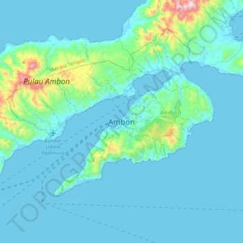
Name: Ambon topographic map, elevation, terrain.
Location: Ambon, Honipopu, Ambon, Moluccas, 97124, Indonesia (-3.85594 128.01879 -3.53594 128.33879)
Average elevation: 305 ft
Minimum elevation: 0 ft
Maximum elevation: 3,258 ft
Thank you for supporting this site ❤️
Make a donation
Make a donation
Gear up for your next adventure:
As an Amazon Associate, this site earns from qualifying purchases at no extra cost to you.