Geolocate

Midway topographic map

Click on the map to display elevation.

About this map

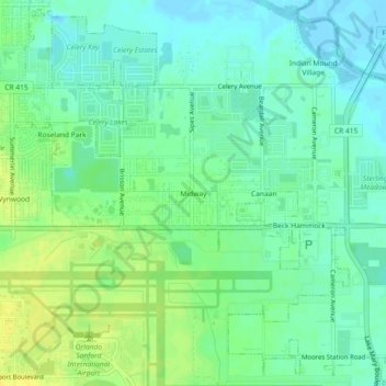
Name: Midway topographic map, elevation, terrain.

Location: Midway, Seminole County, Florida, United States (28.77027 -81.25090 28.81027 -81.21090)

Average elevation: 30 ft

Minimum elevation: -3 ft

Maximum elevation: 69 ft

Seminole County trails, hiking, mountain biking, running and outdoor activities

Other topographic maps

Click on a map to view its topography, its elevation and its terrain.

Paulucci Park

United States > Florida > Seminole County > Sanford

Average elevation: 16 ft

Lake Harney

United States > Florida > Seminole County

Average elevation: 10 ft

Cranes Roost

United States > Florida > Seminole County

Average elevation: 85 ft

Fern Park

United States > Florida > Seminole County > Fern Park

Average elevation: 98 ft

Gear up for your next adventure:

🖼️Topo Map Wall Art - Decorative topographic prints of famous peaks and regions
🪶Thermal Camp Blanket - Extra warmth for cold nights
🚑Emergency Bivvies - Heat-reflective sleeping bags for survival situations
📚Navigation Handbooks - Master the art of reading topographic maps and using a compass
🔋Solar Power Banks - Keep your GPS and phone charged in remote wilderness areas

As an Amazon Associate, this site earns from qualifying purchases at no extra cost to you.