
Thank you for supporting this site ❤️
Make a donation
Make a donation
Gear up for your next adventure:
As an Amazon Associate, this site earns from qualifying purchases at no extra cost to you.
顺化镇 topographic map
Click on the map to display elevation.
Thank you for supporting this site ❤️
Make a donation
Make a donation
Gear up for your next adventure:
As an Amazon Associate, this site earns from qualifying purchases at no extra cost to you.
About this map
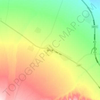
Name: 顺化镇 topographic map, elevation, terrain.
Location: 顺化镇, 民乐县, 张掖市, 甘肃省, 734500, 中国 (38.42656 100.67836 38.50656 100.75836)
Average elevation: 7,552 ft
Minimum elevation: 6,975 ft
Maximum elevation: 8,212 ft
Thank you for supporting this site ❤️
Make a donation
Make a donation
Gear up for your next adventure:
As an Amazon Associate, this site earns from qualifying purchases at no extra cost to you.